You have access to a hypothetical URBANopt example project that was created to demonstrate various capabilities of the URBANopt™ SDK (e.g. modeling of various building types and heights in one district). An actual location for the hypothetical project was needed to demonstrate geospatial aspects of the URBANopt SDK.
The hypothetical example project’s location is within the boundary of an actual district project that was a participant in the U.S. Department of Energy Zero Energy District Accelerator. See “Western New York Manufacturing Zero Energy District” in this NLR paper for a description of the actual project. The design in the hypothetical URBANopt example project has no relation to the designs and site requirements of the actual development project.
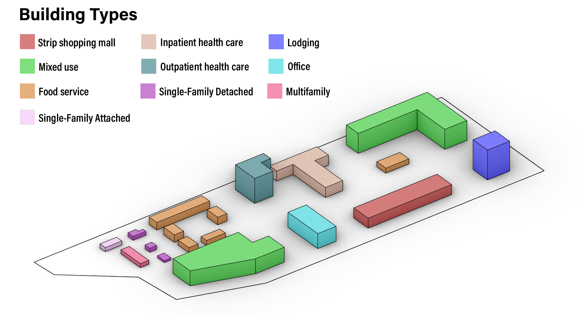
The hypothetical example project design and building typologies are shown in the figure below.
The example project can be installed via the Command Line Interface with the following command. For more information, visit the Getting Started page.
uo create --project-folder <path/to/PROJECT_DIRECTORY_NAME>
Working with the example project, you’ll be able to:
-
Experiment with two pre-built example scenarios: a baseline scenario that creates the geometry, and a high-efficiency scenario that also applies energy efficiency measures.
-
Use the urbanopt geometry creation measures found in the ‘base_workflow.osw’. For a description of the measures found in the base URBANopt workflow, visit the base workflow page.
-
Specify an existing detailed model for a feature by setting the detailed_model_filename property in the Feature file, which will bypass the urbanopt geometry creation measures.
-
Use site-level data (such as climate zone, weather filename, etc.) to set building measure arguments (in the BaselineMapper.rb file)